One of the most important geographical blessings of India is the Peninsular Plateau. It is one of the most ancient forms of land on earth. Go through this article to understand and know more interesting facts about the Peninsular Plateau. 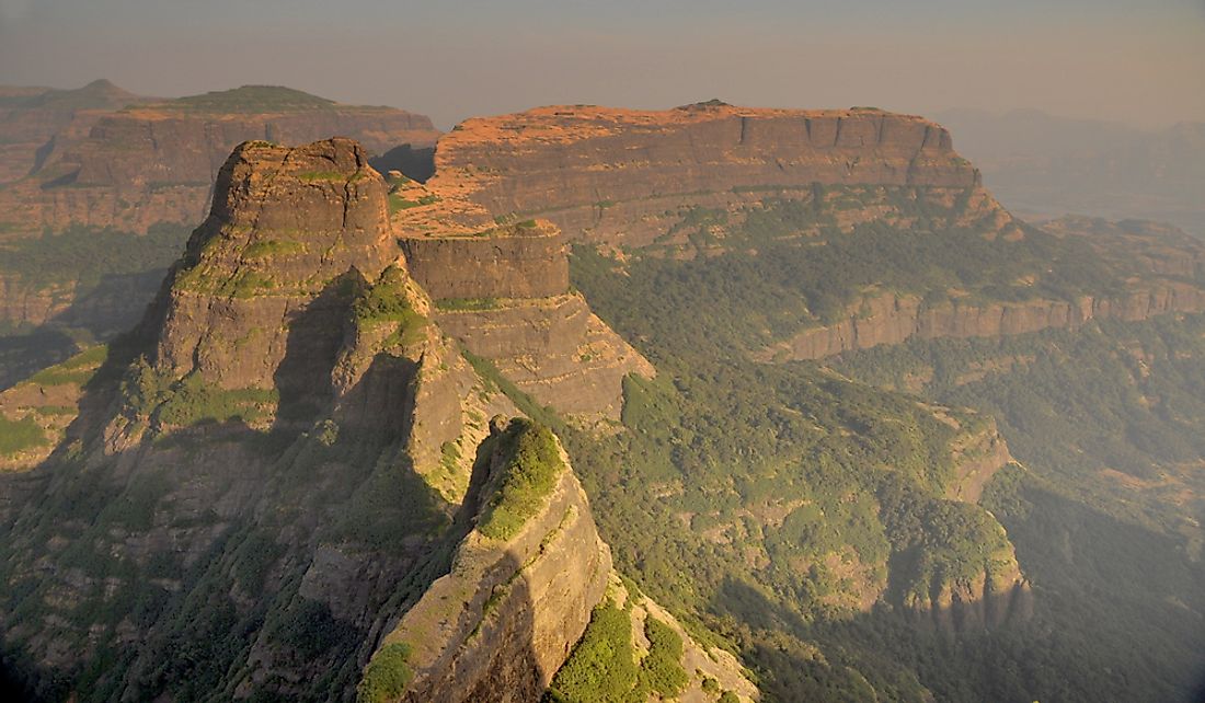
About the Peninsular Plateau
The Peninsular Plateau was formed because of a tectonic shift in Gondwanaland. Because of this tectonic shift, a plateau was formed, which was triangular in shape. It was popularly recognized due to its curved hills and channels. The Peninsular Plateau covers eight states of India, namely – Rajasthan, Maharashtra, Gujarat, Telangana, Karnataka, Tamil Nadu, Kerala, and Odisha.
The total surface area as covered by the Peninsular Plateau is about 16 lakh square kilometers. This Plateau is approximately 600 to 900 meters above sea level. Almost all of the Peninsular rivers flow from west to east as per the slope of the plateau. The only exceptions to this flow are the rivers Narmada and Tapti. These rivers flow from east to west through a rift. The Peninsular Plateau is created from many small plateaus hill ranges that have been spread across river basins and valleys. This includes both shallow valleys as well as rounded Hills.
This plateau has been popularly categorized into two small plateaus – the Central Highlands and the Deccan Plateau. The central Highlands includes the Malwa Plateau, the Bundelkhand, the Baghelkhand and the Chota Nagpur Plateau. And the Deccan Plateau consists of the Deccan Trap, the Western Ghats, the Eastern Ghats, and the North East Extensions. That region of the Peninsular Plateau which lies to the north of the Narmada river, is known as the Central Highlands. The Malwa Plateau covers the majority of its area. The Deccan Plateau is especially popular because it forms a triangular piece of land, and it lies to the south of the river Narmada.
Different Plateaus in India
Here is some more information about the different types of Peninsular Plateaus :
Central Highland of India
The Central Highland of India is popularly known as Madhya Bharat Parvat. It is located amongst the Narmada river in its north, The Aravallis in its north and Vindhyas in its south. The Central Highlands has 4 main small plateaus in it. Here they are:
The Malwa Plateau
This plateau is usually recognized as an extension of a Deccan Plateau. It covers the area of Gujarat, Madhya Pradesh, and Rajasthan. It has a dual drainage system. By this, we mean that it has Narmada, Tapi and Mahi rivers towards the Arabian sea. And it has Chambal and Betwa directed towards the way of Bengal.
The Bundelkhand Plateau
It covers the part of central India, mainly Madhya Pradesh. This plateau has an altitude of over 300 to 600 meters above sea level. This plateau has the Vindhya hills in it, and it is separated by ravines.
The Baghelkhand Plateau
This plateau has an uneven surface and is covered with limestones, sandstones and graphite in its mainland. The plateau is located in the north of the Malakai ranges.
The Chota Nagpur Plateau
This plateau is situated in the northeastern part of the Central Highland. It covers the Indian states of Chattisgarh and Jharkhand. It follows a drainage system that is radial in nature.
The Deccan Plateau of India
The Deccan Plateau of India is triangular-shaped and is one of the most beautiful topographical parts of India. It has 4 main plateaus. Here they are:
The Deccan Trap
This is located in the northwestern part of the Deccan Plateau. The surface of this part of the Deccan Plateau is full of lava.
The Western Ghats
It is popularly known as Sahyadri. It covers the states of Karnataka, Tamil Nadu, Goa, Kerala, Maharashtra and Gujarat. UNESCO has acknowledged the Western Ghats as a World Heritage site. It is one of the 8 biodiversity hotspots on the entire planet.
The Eastern Ghats
The Eastern Ghats indicates a region of discontinuous mountain ranges on the east coastline of India. These Ghats cover 5 Indian states, namely, Telangana, Tamil Nadu, Odisha and Karnataka. It has the rivers Godavari, Kaveri, Mahanadi and Tungabhara pass. It also comprises different national parks and wildlife sanctuaries that are popular across the world.
The North East Extensions
This is popularly known as the Meghalaya Plateau or the Shillong Plateau. The plateau has a design like that of a rolling tableland. It is basically constituted of ancient rocks, iron ores, coal, lime, sillimanite and uranium. This plateau has the maximum rainfall in the entire country.
Conclusion
The Peninsular Plateau is one of the oldest plateaus of India and is the pride of India. Let us know in the comments section which geographical articles you would like to read next!